
This post is about cloud-based data storage. Simple Storage Service (S3) is one of the most used cloud services on Amazon AWS. There are many reasons why a company might want to store data in the cloud, such as for building cloud-native applications, for archives, or even for hosting static […]
Estimated reading time: 3 minutes

UAV’s (drones) are becoming more widespread as a forest management tool. Common uses for drones in forestry include land inspection, photography/videography, aerial spraying of pesticides, and aerial photogrammetry. In this post I will discuss some recent experience I gained with aerial photogrammetry using a drone. Selecting the right drone for […]
Estimated reading time: 8 minutes

If you have a need for converting coordinates between two different Coordinate Reference Systems (CRS) quickly, then this post is for you. In this post I will introduce a Geospatial Library called PROJ that was created to project, transform, and convert geographic coordinates. Example Case You are a consultant managing […]
Estimated reading time: 9 minutes

Modern web applications are useful software solutions that can be accessed from any web-connected device. Most of the newer applications are responsive (i.e. the user-interface adjusts automatically to suit the device viewport size) and are compatible with most modern Web Browsers. However, a professional quality web application can take hundreds, […]
Estimated reading time: 10 minutes

Ever wondered if you should learn a programming language? If so, stick around. In this article, my goal is to present a high-level view of two languages I have found useful in my forestry career for automating repetitive tasks — R and Python. My hope is that someone will have […]
Estimated reading time: 6 minutes

Harvest scheduling is a resource planning process aimed at deciding what areas of the forest (i.e.; stands) to harvest and when. On a small scale, Forest Managers may simply rely on experience, memory, and/or field notes when planning harvests. However, on a larger scale, this is inefficient and highly frowned […]
Estimated reading time: 11 minutes
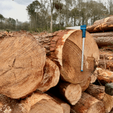
In 1991, the USDA Forest Service, Southeastern Forest Experiment Station created a set of stem-profile taper models for 58 southern species and species groups. The Research Paper, known as SE-282, can be downloaded here. The research demonstrates how profile models are used to “predict stem diameter at any height” and […]
Estimated reading time: 10 minutes

Forest consulting and management firms often rely on commercial GIS software to map, store and analyze data about their land holdings. It’s not uncommon for such companies to spend tens of thousands of dollars annually to maintain commercial software licenses. In this article, I’d like to challenge the status-quo and […]
Estimated reading time: 7 minutes

Data can come from internal or external sources. In many cases, companies need access to data that is not provided by the ongoing operation of the business. For example, forestry businesses may rely on products and applications developed using regional timber prices, historical weather patterns, location-based services, or market indices. […]
Estimated reading time: 13 minutes