
Most foresters may never have the need or desire to learn SQL, and that’s okay. Nevertheless, I think there are good business reasons for learning the language of relational databases. Foresters who know SQL have an appreciation for how data is stored, why it’s important for data to be clean […]
Estimated reading time: 5 minutes

This post is about work productivity, and how Agentic AI (Agents) are changing how we think about business workflows. Agents use underlying Large Language Models (LLM) to perform tasks autonomously with simple prompting. Agent applications can integrate with other software such as Google Drive, Microsoft Office, Gmail, and web browsers […]
Estimated reading time: 6 minutes

The forester’s role isn’t disappearing, its rapidly changing. Over the next five to ten years, technology will shift the job from boots-on-the-ground data collection and monitoring toward data interpretation, strategic decision making, and cross-disciplinary collaboration. The forester will need to know how to leverage technology on the job to get […]
Estimated reading time: 4 minutes

Timber inventory (i.e., timber cruise) data can be stored in various ways. I find that it’s best to store this type of data in a relational database. A Geospatial database is another suitable choice after the data is cleaned and ready for analysis. Processing bottlenecks can occur when timber cruising […]
Estimated reading time: 5 minutes

This article is similar to an earlier post titled Mapping Geotagged Photos that explains how to map photo locations using ArcGIS Online. This version will be more technical, but provide flexibility for what data to extract and the output format (eg. stored to a database or local file). If you […]
Estimated reading time: 6 minutes
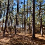
A few days ago, I was cruising timber and had just finished up my last plot for the day on the back of the property where I was working. The timber stand I was in had an understory burn this past spring. As I finished tallying the plot I noticed […]
Estimated reading time: 3 minutes

This post will discuss a simple method for land cover classification using a k-means clustering algorithm with Spectral Python (SPy). Spectral is a pure-Python package for processing hyperspectral images and is available for download using Pip or Conda. Let’s say you are working on a suitability analysis project and want […]
Estimated reading time: 4 minutes

Many forestry companies rely on GIS software. Commercial GIS software solutions like ESRI ArcGIS are well known, but there are open source (OSS) options available as well. Smaller companies and startups may want to try open source before making a large investment in a commercial GIS solution. Established companies may […]
Estimated reading time: 4 minutes

This is a handy little tool that I use in the field and want to capture photos to add to a property map. There are several ways to do this, but since most foresters are familiar with ArcGIS, I will describe how this works with an iPhone and ArcGIS Online. […]
Estimated reading time: 3 minutes

New traceability requirements brought on by the European Union Deforestation Regulation (EUDR) will soon go into effect. Companies, trade groups, and operators doing business with the EU are working to develop solutions to comply with this new regulation. At this point it seems no one has a handle on how this will […]
Estimated reading time: 4 minutes


